The best trails in Ketchikan Alaska
Fifteen of my favorite trails in Ketchikan, from short strolls through parks in town, to all day ridge line adventures there are tons of trails of many varieties for anyone to get out and enjoy nature in Ketchikan.
In town:
Married Man’s trail: 2 miles, easy
A boardwalk and gravel trail just off of Creek Street in downtown Ketchikan. This trail follows the creek further up and ends at a fish ladder if you stay on the lower route. If you head up the stairs you’ll enjoy views of the town and the water through the trees and end at the Cape Fox Lodge Hotel & Restaurant. The restaurant has great views, there is also a small lawn with multiple totem poles located outside the main entrance. This is a great place to see a number of poles if you aren’t able to go to one of the totem parks while visiting. It is a great short walk to feel like you are in nature, but not have to venture far or long.
Bike path to Saxman: 5 miles roundtrip, easy
A paved path offset from the road along the water, it is a flat couple mile walk from town out to the native village of Saxman. Along the way out you will pass by the local canneries, Coast Guard Base, and have great views of the water and surrounding islands. On some days you might even see whales go by. Once you get to Saxman Village you can see totem poles, a clan house, and stop by the carving shed to see artists actively working on new totem poles. You can walk back into town or take a taxi to make the trip shorter.
Rainbird trail: 2 miles, moderate
A sort trail up above the bypass road that passes above Ketchikan linking the two sides of town. The trail lots of stairs at the start and end, but great views looking over Ketchikan and the narrows. You can see many other islands on a clear day. Part of the trail is in the trees, giving it a nice foresty vibe even so close to town.
Deer Mountain: 6.7 miles, difficult
A steep trail up the most prominent mountain in town. It is an all day adventure to get up and down it with about 3,000 feet in elevation gain, but the views are incredible. There are several viewpoints along the way to enjoy or even make those your destination if you don’t have the time or energy to make it all the way to the top. If you only have time for one major hike in Ketchikan, make this one it.


Carlana Lake: 2 - 5.5 miles, easy - moderate
It is a short hike along an access road to the lake, if you want something easy you can turn around here. If you continue a little further along the right side of the lake there is also a well developed trail past the lake that goes to a couple different platforms you can fish off of or just sit in the sun. If you want to go further the trail continues all the up to the ridge above. It is a steep climb to the ridge, but only about five and half miles total if you go all the way up and back down, so not generally an all day commitment. There are great views from the ridge and once you pop out of the treeline before it.
Out of Town:
Minerva Ridge Traverse: 8 miles, difficult
The best way to do this is start at the Carlana Lake trailhead in town, which is discussed above. You hike up the ridge and continue back down to Perseverance Lake and end up near Ward Lake. This is a point to point hike, so you will need to have a pickup or stage a second car at the end of the hike. The trail is not always well marked, so it is a good idea to have a GPS device with you. The trail is shown on the Alltrails and Gaia apps.

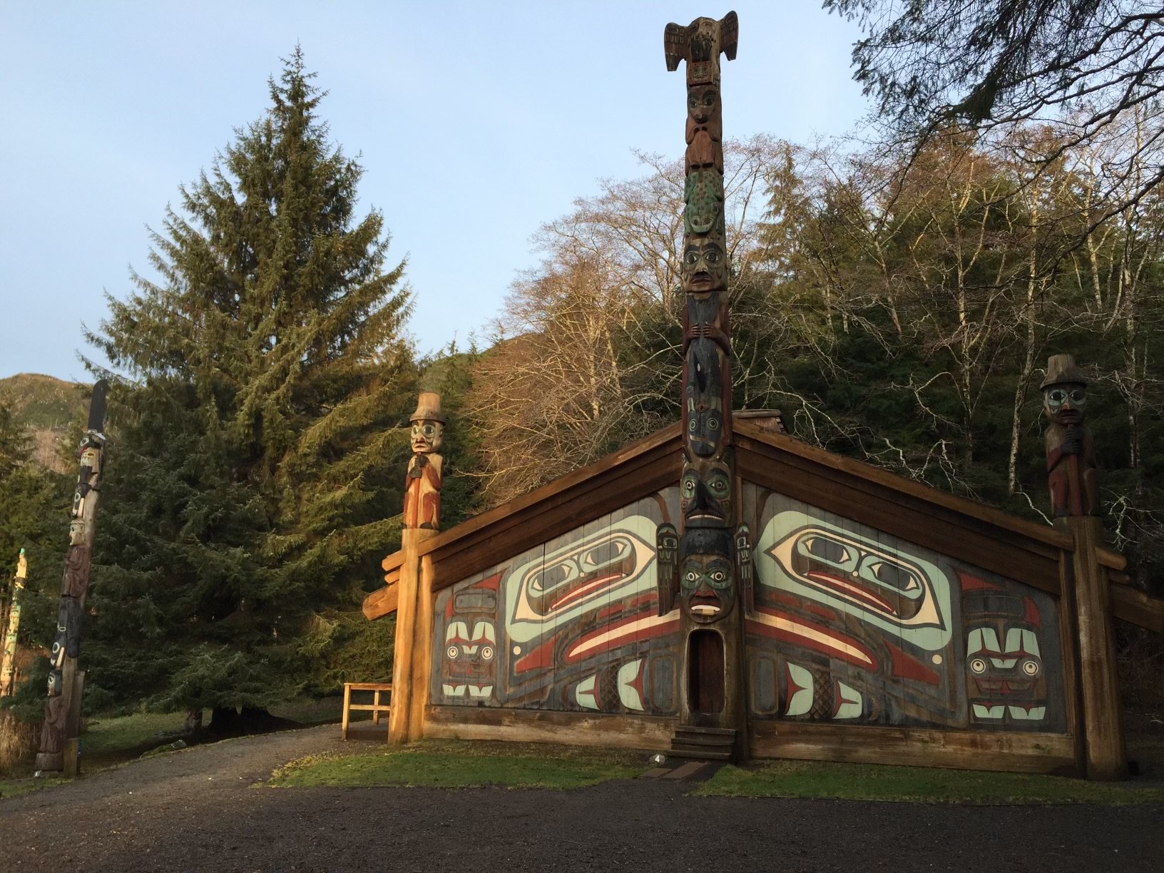
Totem Bight State Park: 0.5 miles, easy
Totem Bight is located about nine miles north of downtown Ketchikan. There is a parking lot located just off the highway. There is a short gravel trail from the parking lot that leads to the Tlingit Clan House, Totem Poles and a wood platform with great views of the ocean. You can even get down to the beach from the trail.

Bike path from Buggies Beach to Mountain Point: 6 miles, easy
South of town if you park at Buggies Beach you can hop on a paved bike path. Follow the path all the way to Mountain Point as it follows the coastline. You might even get lucky and see whales going by. When you arrive at the gravel lot at Mountain Point there is a small trail leading down to the beach if you want to check out the water and views before heading back.

Ward Lake Loop: 1.5 miles, easy
A mile and half long loop trail around a beautiful lake. It is a well groomed trail with small trails to different picnic sites and shelters along the way. There is also a campground on one side of the lake you pass through which has outhouses if you need to stop for a pee break. You will need a car to access the trail it is located about 7 miles north of downtown Ketchikan and a short well marked drive off the highway. There are also lots of other trails and campgrounds in the Ward Lake area.

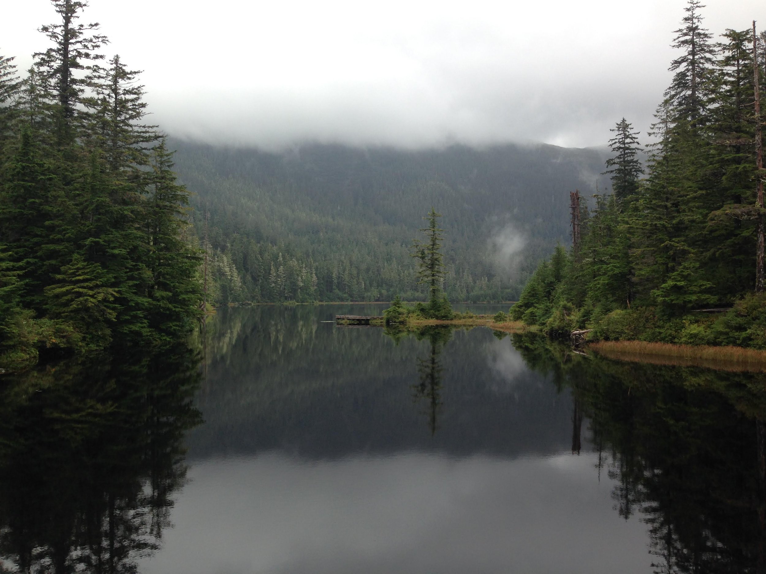
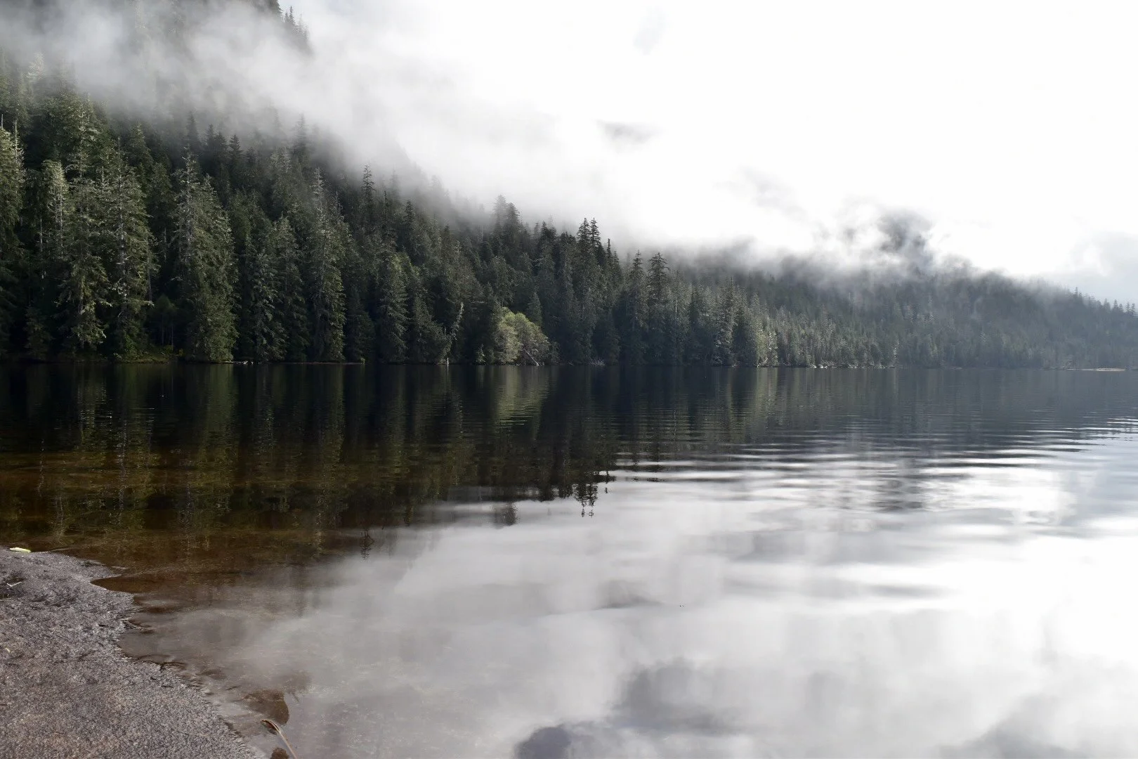
Perseverance Lake: 6 miles, moderate
The trailhead starts near Ward Lake and is three miles up to the lake with gradual elevation gain of about 1,200 feet total. It is a gravel and boardwalk trail that is pretty well maintained and easy to follow. Once you reach the lake you can continue along the trail until it heads up the ridge or just pick anywhere along the lake to stop and have a picnic. There is a tent platform in the trees you can see off from the trail and that area is a great place to enjoy your lunch. Or of course pitch your tent if you are planning to camp. This is a great moderate hike and clouds and rain won’t detract from the beauty of the lake.
Dude Mountain: 2.5 miles, difficult
To get to the trailhead you will need to drive several miles up an old logging road called Brown Mountain Road. This gives you a great head start on gaining elevation making this hike probably the best views for the amount of effort on the island. The trail is boardwalk at first and then changes to just following foot paths through the alpine and rocks. There is also a tent platform partway up, if you want to camp along the trail. There are some pretty steep sections, but overall not a long or technical hike. At the top there are many rocks and ponds and you can wander the ridgeline and hang out. There are flat places to pitch tents if you want to do this as an backpacking trip.


Lunch Creek Falls Loop: 1 mile, moderate
This trail starts at the Settlers Cove campground. First you cross over a bridge that gives you great views of the waterfall. There are little offshoots from the trail that will take you down to the beach and creek or up to another viewpoint for the waterfall. If you want to do the full loop continue over the bridge. You can go right or left as the trail loops around. Going up first will take you through the woods before you end up back down along the water. There are a couple access points to little beaches off the trail. The trail does have some slick boardwalk stairs if you do the whole loop. If you want to avoid climbing just head directly down to the beach after crossing the bridge.


Silvas Lake & Upper Silvas: 4-6 miles, moderate - difficult
The trail to Lower Silvas lake is an access road used by the power company, it is a steady climb, but easy to follow and a wide gravel road the entire time so it is relatively easy hiking and pretty kid friendly. It also makes the trail easy to follow in the snow. Once you reach the damn and the end of the road the trail gets more rugged and the last part is a steep climb that is not well marked to Upper Silvas Lake. Many people turn around at the lower lake if they are not comfortable with some route finding. Both lakes are very beautiful, but the upper lake definetly feels more remote and Alaskan. If you really want an adventure there is a very rudimentary trail that continues up to Mahoney Mountain and Lakes, but requires route finding skills and is over ten miles round trip.
Connel & Talbot Lake: 4 miles, moderate
This trail starts at the Connel Lake Damn near ward lake and requires a car to access the trailhead. The trail winds through the woods for about a mile before coming out at the other end of the lake. You can see many old trees in the lake from when the resevoir was created by the damn. Just a little past the end of Connel Lake the trail continues to a smaller natural lake, Talbot Lake, which is a great spot for trout fishing.


Coast Guard Beach: 1.6 miles, moderate
The trail starts at the parking lot for Point Higgins Elementary about 15 miles north of downtown Ketchikan, so it will require a car or other transport to access the trail. The trail is gravel and boardwalk, but can be muddy in parts if it has rained a lot. There are small ups and downs, but it is relatively flat as it weaves through muskeg and forests until reaching the ocean. There is a gravel beach, large rock formation, and a nice point with tidepools at low tide to explore. On a sunny day it is wonderful place to bring a towel and picnic and hang out on the beach for a while.