The best trails in Petersburg Alaska
The best trails both hikes & leisurely walks in and around Petersburg, Alaska. From easy strolls to tough climbs, no matter your activity level there is sure to be many ways for you to get out enjoy nature in this beautiful Southeast Alaskan town.

Trails and paths in and around downtown Petersburg, Alaska
Hungry Point Trail: 1-2.5 miles, easy
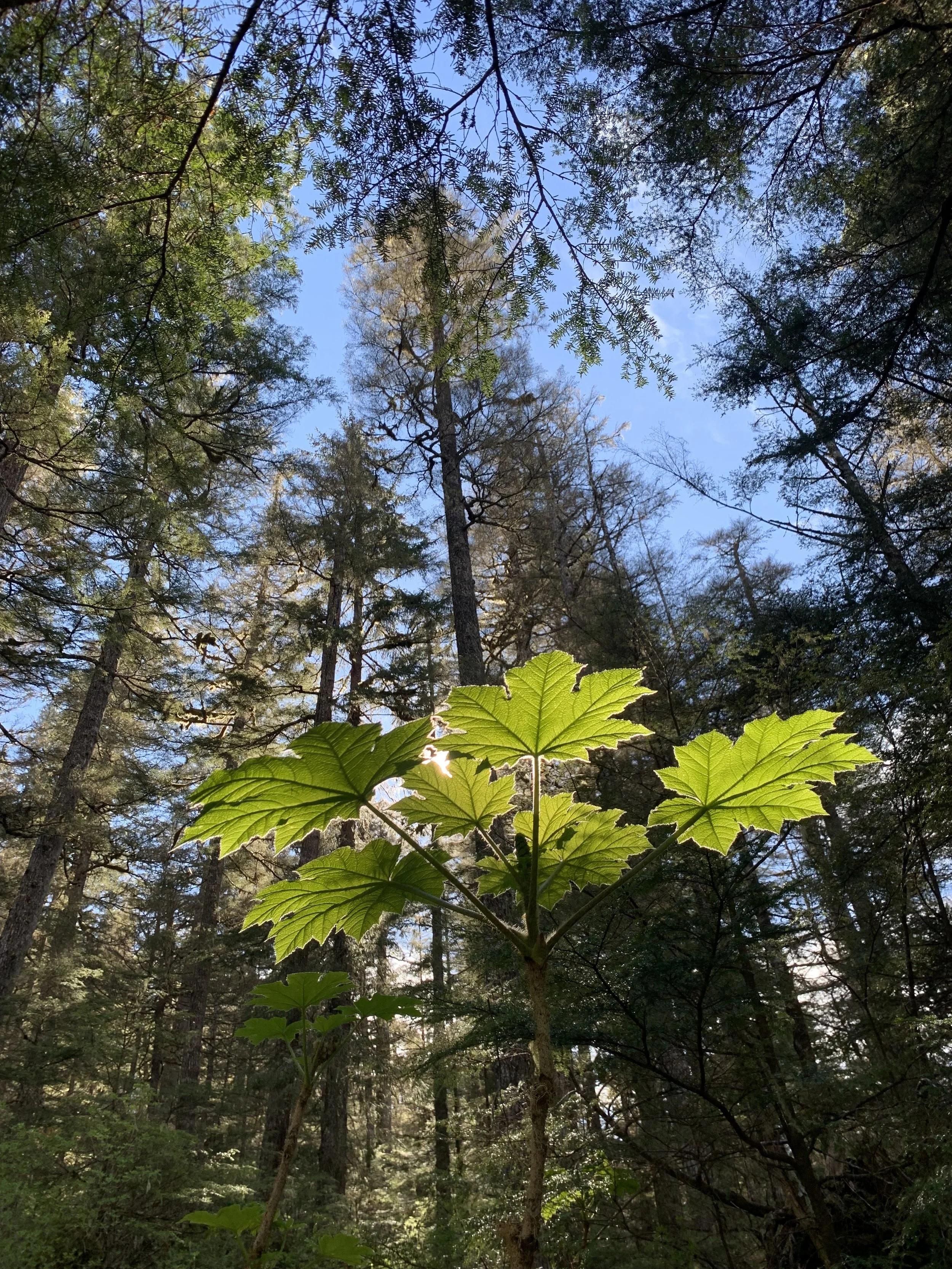
A boardwalk and gravel trail located right behind downtown, there are several different loops you can do to make the trail a variety of lengths ranging from about a half mile to two and a half miles. On a clear day you have views of the coast range including Devils Thumb one direction and Petersburg Mountain on Kupreanof Island the other direction. Even on a rainy foggy day you can enjoy the beauty of the muskeg surrounding the trail. The trail can be accessed from the baseball fields, next to the Elementary school, Hungry Point on Sandy Beach Road, and off 14th street.


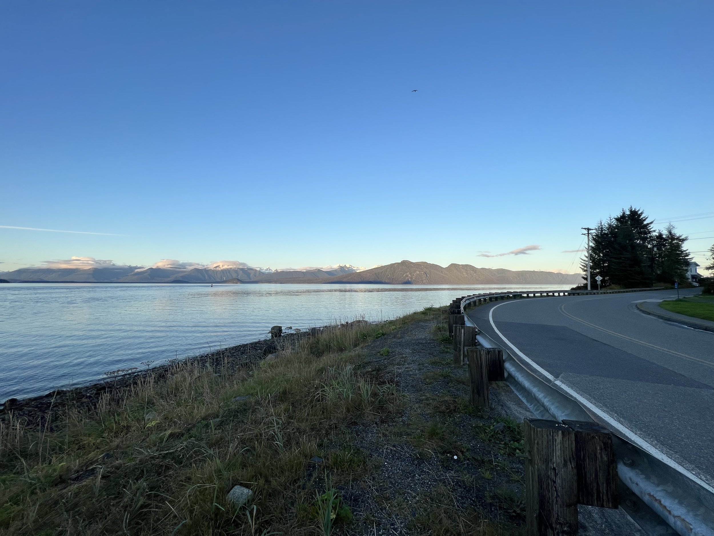
Walk North Nordic Drive: 1.5 miles, easy
Just over the hill from downtown, stroll the sidewalk out along the entrance to the Wrangell Narrows. You’ll be able to take in views of Devils Thumb and the surrounding ice capped mountains. If you are lucky you may see a barge and tug or one of the Alaska State Ferries going through the narrows, which are some of the largest vessels that make the passage. If you walk to the point where the road makes a large turn, you can link up to the Hungry Point trail and return downtown looping through the muskeg.
City Creek Trail at Sandy Beach: 2 miles, moderate
From Sandy Beach walk through the woods along the edge of the beach for about a mile to city creek. The first section is a nice raised boardwalk, but most of the trail is slick old boarwalk or meandering through root piles and over some downed trees. At the end you pop out of the trees at a salmon stream and have great views looking into Fredrick Sound, Horn Cliff, and the Sukoi Islands. You can walk back along the same trail or there is a trail that continues out to Fredrick Point gravel road and you can walk back along there to make it a loop.


Ravens Roost Trail: 2-6 miles, moderate - hard
This trail also starts at Sandy Beach park. You hike up to the first bench for incredible views and something easier, or keep going up for higher up views and a cabin. Ravens roost is a great hike with many viewpoints along the way, so even if you aren’t able to complete the entire hike to the cabin you can still reach nice vantage points. Hike a nice gravel trail a mile up to the first bench, its relatively easy and will still give you nice views and if you are up for more continue from there. If you have time, spend a night or two in the cabin. It's a great spot for sunsets and sunrises, sometimes you might even wake up above the clouds. Check out my full guide to the Raven’s Roost trail and cabin.


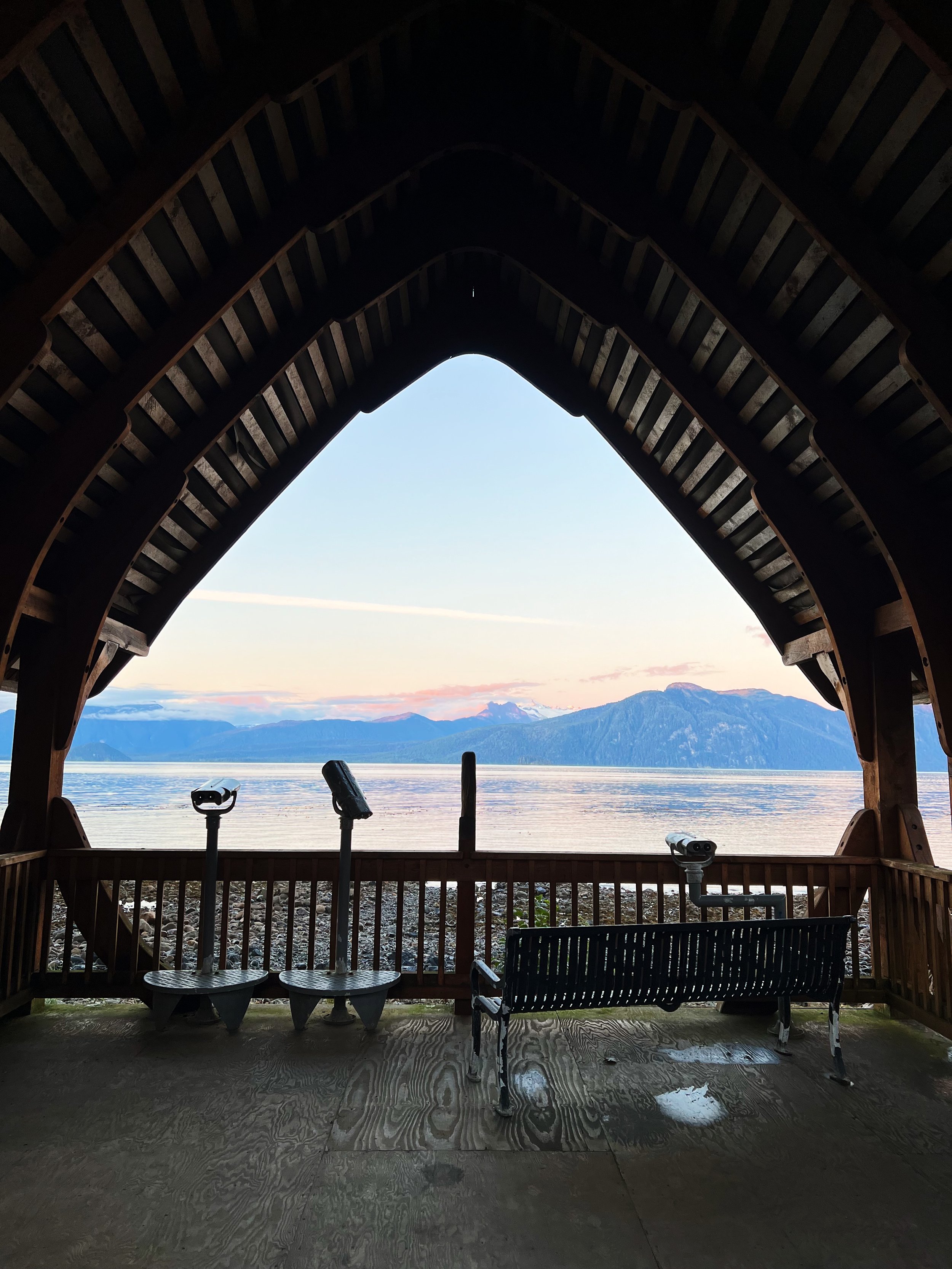
Outlook Park Beach: varies, easy
The beach in front of Outlook Park was the old community dump there is tons of old glass, pottery pieces, glass bottles and other fun treasures you can find while wandering the beach. Spend a bit of time wandering the beach looking for things that catch your eye. Very low tides give opportunities to find treasures that aren’t usually exposed or even just give time to check out sea creatures in the tide pools. If not up for walking along the beach you can park and in a few steps you are in a wonderful wooden overlook structure that provides a wonderful spot to take in views of the mountains.
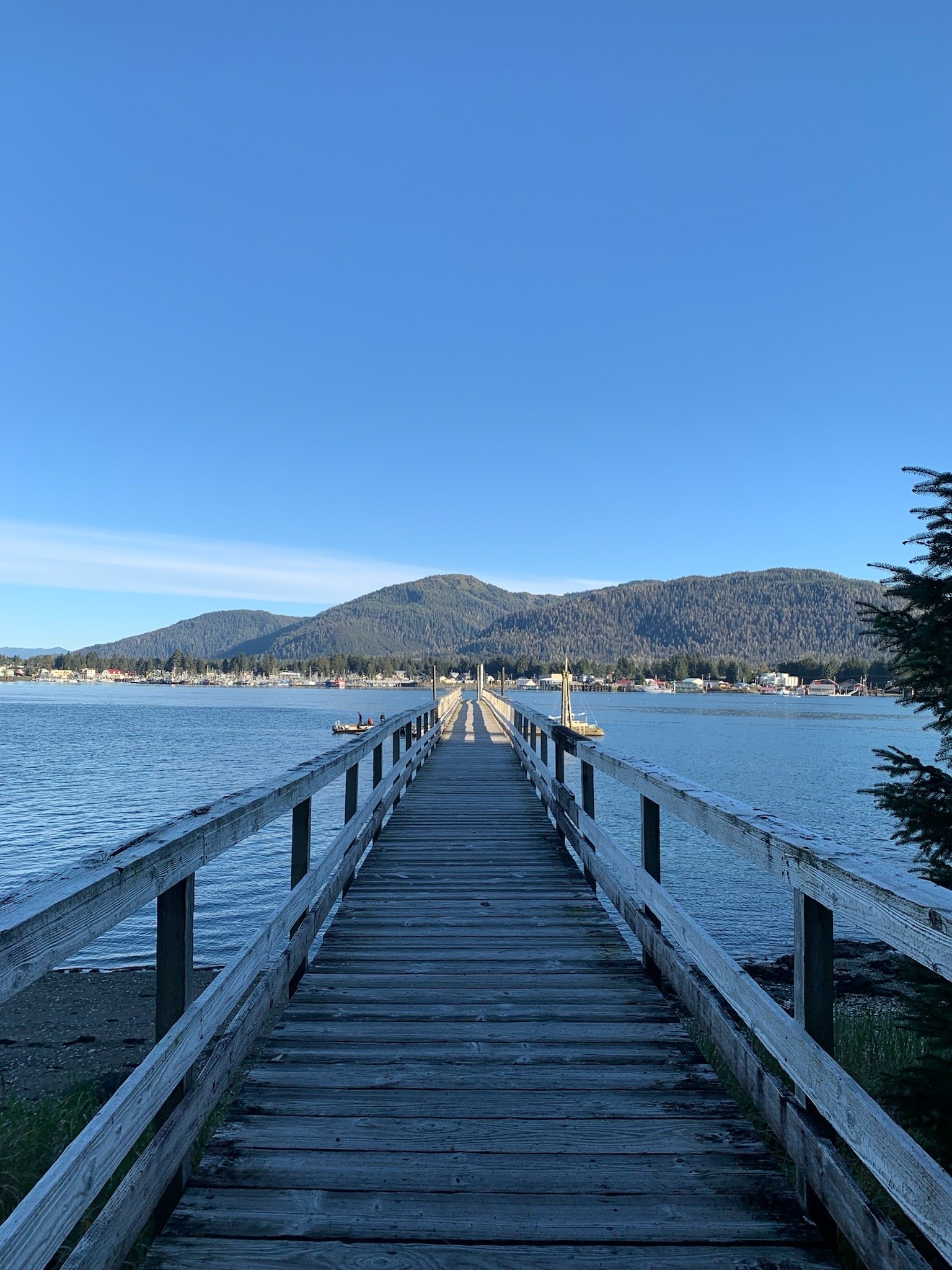
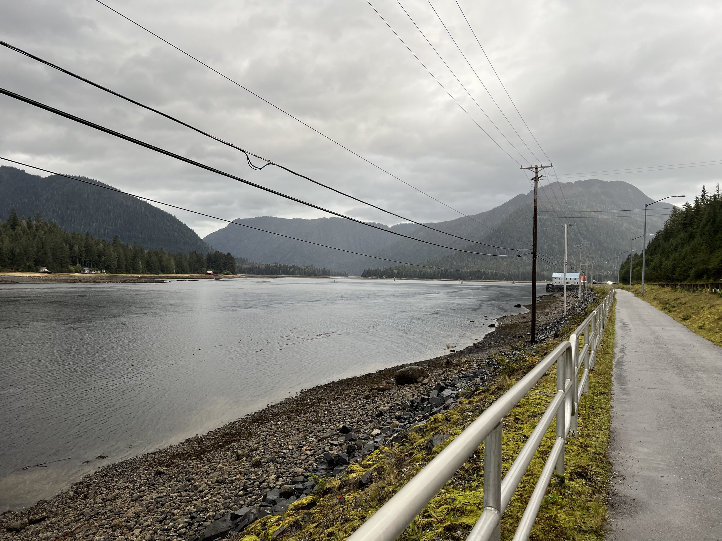
Libby Straits Bike Path: 2 miles, easy
A paved bike path along the Wrangell Narrows that is offset from the road slightly. You get great sunset colors here as you look up Petersburg Creek, its a great spot for an evening stroll and is even wheelchair accessible. If you walk the whole strech out and back it is about two miles.
Trails out of Petersburg, but on Mitkof Island
Three Lakes & Ideal Cove Trail: 1-7 miles, moderate
To reach the trailhead drive out Mitkof Highway twenty miles, then turn on to the three lakes loop dirt road and it is another 5-7 miles to the lakes, depending on what lake you start the trail at. The trail here loops around three lakes, hence the name, but also has a portion that goes out to the coast in ideal cove, with great views of some of the coast range, Frederick Sound and you can frequently see icebergs coming out of Leconte Bay. This trail is great for everyone because you can really make it as easy or strenuous as you want. Looking for an easy day just park and walk into one of the lakes and paddle around on one of the provided row boats or want to see it all, hike the full 7 miles past all three lakes and out to ideal cove, or any combination in between. The trailheads for each lake are pretty clearly marked along the road and each lake is only about a half mile from the road, so even if you are only up for an easy hike you can visit at least one lake. Trail maps are available on most trail apps like Gaia, All Trails and Earth Mate.


Crystal Lake & Mountain Trail: 3-7 miles, difficult
Looking for something a little more laid back then just go to the lake, it is a steady climb, but not a super long hike. Have lots of time, head all the way up the mountain for more great views. This is not a well maintained trail, so expect to spend some time climbing up and over downed trees, but it is beautiful and worth the climb. The trail starts at the Crystal Lake Hydro Facility at the pull off for the Blind Slough Recreational area and is marked with pink flags up to the lake. After that you are out of the trees and can kind of make your own way up through the alpine if you’re heading to the top. There is also an unmainted trail leading to the top of Crystal Mountain accessed from a small pull off on the Snake Ridge road, but this is difficult to find without some local knowledge and requires a four wheel drive vehicle to access.


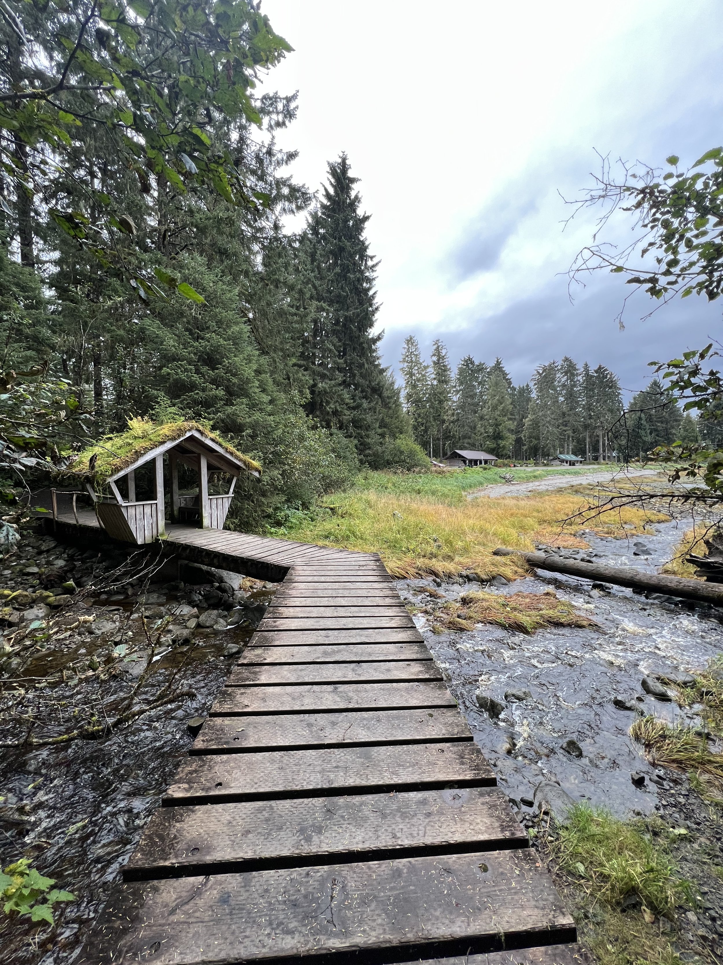
Blind River Rapids Boardwalk: less than one mile, easy
Possibly one of the best views for the shortest walks on the island. It is an easy short walk to the rapids on a boardwalk, you have great views of Crystal Mountain behind the rapids. It’s also a great spot to fish when the Kings and Cohos are returning to the stream. For a little more of a walk you can complete the full boardwalk loop through the muskeg. The rapids are also a great spot for fishing in the summer because there are hatchery King Salmon and Coho Salmon that return to Blind Slough.

Ohmer Creek Trail: 2.5 miles, easy
The trailhead starts just off Mitkof highway, there is a nice pull off for parking. The trail winds along Ohmer Creek and then there is a bridge to cross over a beaver pond before cutting into the forest and muskeg. At the end of the trail you end up on a logging road, at this point you can turn around and go back the way you came, or make it a loop and take a left down the logging road and then another left at the T in the road. There are a couple signs with hiking icons on them that help point the way. In the spring the gravel road is lined with Lupine and other wildflowers.


Twin Creeks: varies, moderate
Turn off Mitkof highway about at 7 mile up Twin Creeks Road, drive up the road until you reach the Twin Creeks Shelter or even stop before and just walk along the logging roads. If you are not feeling like a hike the shelter is a nice spot to have a fire and/or picnic. If you are game for some more offtrail exploring, put on some good waterproof boots and wander through the muskeg. On many trail apps there is a well mapped snowmobile trail you could follow via GPS and occassional blue trail signs. The whole trail if you went out and back would be a long slog through the muskeg, but does take you to another three sided shelter with a wood stove. I usually do just a short section of it to take in the beautiful views.

Trails in the surrounding area, accessible from Petersburg by boat
Petersburg Mountain: 7 miles, hard
Take a boat or kayak across the narrows to Kupreanof Island public dock to reach the trailhead for Petersburg Mountain. The trail starts flat along an old road for about the first mile, then it is a steady climb up with a mix of wooden stairs and dirt trail. The very last push to the ridge top is so steep there are cables in sections to hold and pull youself up or have something to hold on to on the way down, but don’t let that scare you off the views from the top are incredible. Give yourself all day to complete this hike, it is long and difficult, but it is 100% worth the effort for the views from the top.


Cascade Falls/Falls Lake/Swan Lake: 2-8 miles, moderate - hard
About the first mile of the trail is well maintained gravel trail that will take you past big waterfalls, through the trees and to a lookout where you can see the river gorge below. Most people turn around here and head back, but if you are up for an adventure you can continue on to a much less well maintained rough trail and boardwalk to Falls Lake and then on to Swan Lake. If you go all the way to Swan Lake it is about 8 miles round trip, but if you stop at Falls Lake that will cut about 2 miles off the round trip. At the far end of Falls Lake there is an incredible waterfall and a three sided shelter that makes a great lunch spot. If you are in Thomas Bay and want to do an adventurous day hike, going as far as the Falls Lake Shelter is a great option.


Kupernof Loop Trail: 1.5 miles, moderate
You start this trail at the public dock on Kupernof as if you are going to start the Petersburg Lake trail or the Petersburg Mountain trail, you can go either direction as it is a loop, just watch for signs and take the turn off to the Kupernof loop. The mostly boardwalk trail takes you through the trees and muskegs and gives you some views of Petersburg and Petersburg Mountain. It is a fun off island adventure that isn’t a major hike.